Hong Kong. The city – the words – mean a certain home to me. Mean 14-hour-long flights, delicious food and slightly smoggy streets, tangled banyan roots and family roots, red taxis and double-decker buses.
Invariably, to most people, Hong Kong is the city with Bruce Lee, the classic shot with the red-sailed sampan in the harbor, a most easily awe-inspiringly-destructible skyline for Autobots and Kaiju and whatever else have you to battle behind, and for some reason it seems like it’s always the Ground Zero of choice for some screenwriter’s fantasy about the next Death Plague. Oh, and it’s got people. Lots of people.
But today, hopefully I’ll paint a different picture of Hong Kong, one that isn’t quite what I’d known from my own experience until this point and one that’s certainly not what the average person would probably imagine it to be, but still Hong Kong nonetheless.
Crash course on Hong Kong geography (don’t fall asleep yet!)
As much as I might feel like I’m a true Hongkonger (or whatever the appropriate demonym is), I’m really not. (I can’t even speak Cantonese, the local Chinese dialect.) That being said, I know enough geography to give the very basics, which sets the stage for my glorious adventures:
Hong Kong is a sort of city-state of around 1,000 square miles in area, part of which is connected to mainland China just south of the city of Shenzhen, and the rest is distributed amongst a handful of islands. Most of the Hong Kong metropolis is found along the southern edge of the Kowloon peninsula (connected to mainland China) and the northern edge of Hong Kong Island, the second-largest island in Hong Kong’s jurisdiction (after Lantau Island, where the Big Buddha statue and the airport are located). These two towering masses of skyscrapers face each other across Victoria Harbour and comprise the famous Hong Kong skyline, although almost all of the iconic buildings are found on the island (coming up in a later post).
Beyond that, though, Hong Kong is rather undeveloped. The Southern half of Hong Kong Island, along with most of Lantau and the land to the north and east of the Kowloon Peninsula (the latter of which are referred to collectively as the New Territories), are either just too hilly and jungly, or are protected by the government from being replaced with concrete jungle. Thus, aside from a few suburbs that maintain the big-city feel, a significant portion of Hong Kong’s land area is devoted to large parks, cultural sites, and traditional settlements. And within its rainforests and waters hide over 230 species of butterflies – nearly 4 times the number found in the entire UK – and some of the northernmost and hardiest coral reefs in the world (although they may eventually be lost to pollution).
It’s in the eastern New Territories, north of Ma On Shan (the tallest point in Hong Kong), that the Plover Cove Reservoir is located. Once consisting of coastline connected to the ocean, Plover Cove was converted into essentially a large lake by building a large dam across its opening, draining it, and refilling it with freshwater for the use of the city of Hong Kong. Throughout this time, Plover Cove and the surrounding areas have remained popular sites for local recreation – people can bike and walk on the dam, as well as fish the reservoir itself, hike and camp in the surrounding forest, and boat in the ocean on the other side of the dam.
Lakes and mountains, sea and sky
Before my family and I went to the Plover Cove Reservoir and dam proper, we stopped by the surrounding town of Tai Mei Tuk to pick up bikes to rent. From there, it’s about a three-minute ride on flat terrain and another three-minute walk up a shallow gradient (on which you’re not supposed to ride the bike) to get to the dam, which is flanked on both sides by small hills and open circles of pavement, which serve the dual purpose of helicopter pads and turnaround areas for vehicles. Although the dam mostly only sees bicycle and pedestrian traffic, there were a few cars driving along it (likely government workers), and later in the day a fire truck came to put out a small, mysterious fire on the lake shore that was blowing large clouds of smoke over the most heavily-traversed sections of the dam.
From Tai Mei Tuk, you enter the dam from the northwest side (it stretches straight down to the southeast), meaning that the reservoir is to the left and the ocean to the right. For the first couple hundred meters or so, the dam is pretty crowded, but the people thin out the farther away you get from its entrance (maybe a 5-10 minute bike ride to its very end at a leisurely pace).

Even from this point, about a third of the way down the length of the dam, there aren’t many people on the road, and you feel almost transported to the middle of the Southern China coastline – nothing about this place feels like the classic hustle-and-bustle of Hong Kong. To the left, the mountain in the distance with the serrated appearance is known as Pat Sin Leng, meaning “mountain range of the Eight Immortals”. All around 1500 feet in height, each of the eight peaks is named after one of the Eight Immortals of Taoism and Chinese mythology.

At the other end of the dam, which is a little more than a mile long, there are several walking trails that weave around the hills and jungle. Although bikes are not permitted there, fishing and hiking are possible from that end of the reservoir, as several paths lead up the hill and down to the lake shore.


Kite-flying
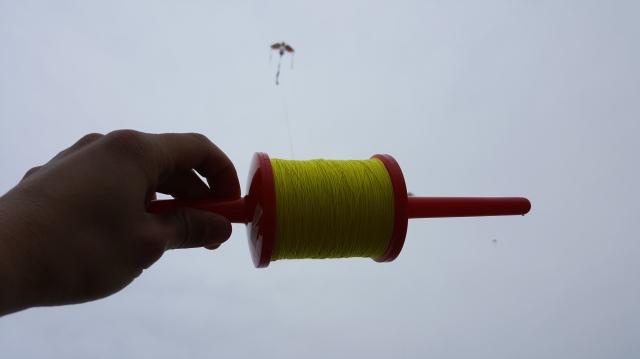
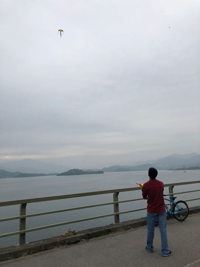
After I rode my bike back to the other end of the reservoir, I met up again with my relatives and we attempted to fly a couple of different kites from the dam. Having a very cluttered skyline and dense forests throughout most of its undeveloped areas, Hong Kong is generally not an accommodating place to fly kites, so large open areas with reliable winds often see lots of people with kites on good days.

The first kite that we brought with us was a large two-line delta stunt kite. And it performed disastrously. The wind was consistently there but it wasn’t constant, nor strong enough to support a kite of this size and type, and the lines were tangled and thus of uneven length. So trying to run the kite out would get it airborne for a max of oh, maybe a second or two before it would plunge like a missile back down to the pavement or over the railing and onto the rocks below. It hit and nearly de-seated a couple of cyclists (including me, when I was first riding back) until an elderly man with a much lighter kite scolded us and we eventually stopped trying.
My aunt eventually went to Tai Mei Tuk to buy a few smaller kites, and these got off the ground (and stayed off) much more successfully:


Snacks by the pier
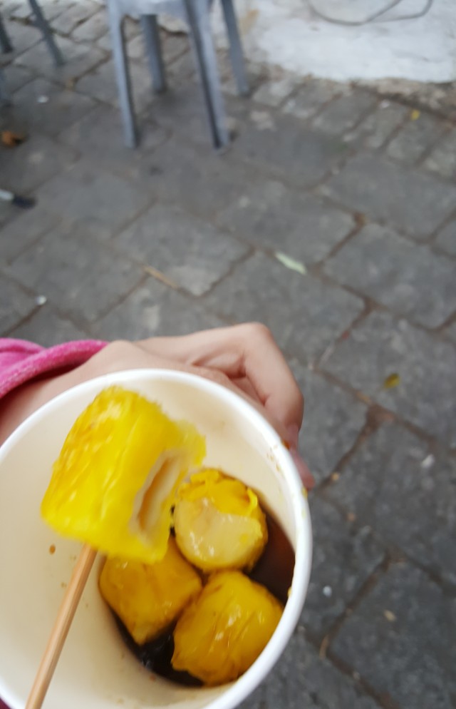
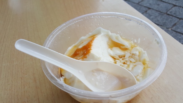
After returning the bikes at Tai Mei Tuk, we stopped by the two small piers to get classic Hong Kong snacks.

These are siu mai (also transliterated shao mai, shu mai, and a billion other ways), small steamed dumplings with a thin dough wrapping and a meat filling. There are a bunch of different variations of siu mai, of which this kind has a fish-ball filling and is the most common type served as street food. Pardon the blurriness of the photo; we wouldn’t stop eating these long enough for me to get a stable shot. And I don’t regret it.

This is a tofu pudding, known as dofu fa (with my own transliteration). It’s a very soft and mildly-flavored type of tofu with a creamy texture; it is eaten sweet, with syrup and sugar sprinkled on top. Normally, I’m not a fan of tofu, but this is one exception I’ll make.

In addition to exploring the Plover Cove Reservoir, it’s possible to rent canoes or paddleboats and explore the small harbor around Tai Mei Tuk. Many boats of different kinds can be found docked here at the two small public piers, and there are lots of little fish that school around them, so I did see people fishing here too. No success, though.
Conclusion
I love it and I want to go back.
Long-story short, that’s my adventures around the Plover Cove Reservoir, which in this trip was my only stint in the New Territories. However, I will be sure to head around there the next time I visit, and hopefully I’ll be able to get nice pictures then and write about it more.
So…writing is slow at the moment, but there’s definitely more on Hong Kong to come. Stay tuned.
